Time lapse imagery of Ryder glacier
Calving processes at marine terminating glaciers are poorly understood, hindering efforts to reduce the uncertainty of future sea level rise estimates. Observational data is often low resolution and satellite-based, meaning individual calving events cannot be identified. During the Ryder 2019 expedition, a time lapse camera was set up overlooking the calving front of Ryder glacier in order to create a high resolution data set of calving events during a 12-day period.
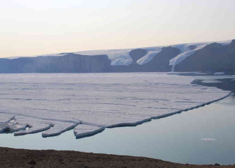
“We placed the camera on a cliff overlooking Ryder glacier, which we accessed by helicopter. Photos were taken every 5 seconds in order to allow detailed analysis into which processes trigger calving. At Ryder glacier, the majority of calving events were linked to waterline weaknesses – suggesting that melting of the ice by the ocean is a key driver of mass loss” says Felicity Holmes.
The project was funded by the Bolin Centre, Stockholm University, and the Polar Research Secretariat.
The time lapse imagery of Ryder glacier is part of a collection of several datasets from the Ryder 2019 expedition, that can be found at Bolin database page.
https://bolin.su.se/data/ryder-2019-expedition-2
https://bolin.su.se/data/ryder-2019-glacier-front-imagery
"The Bolin Centre Database welcomes other scientists at the centre to also publish datasets containing images. Contact us with your ideas," say database staff Rezwan Mohammad and Anders Moberg (bolindata@su.se).
Last updated: October 7, 2022
Source: Bolin Centre for Climate Research