Land covers 30% of the Earth, we study the rest
Marine geoscience – for those who have a passion for the sea
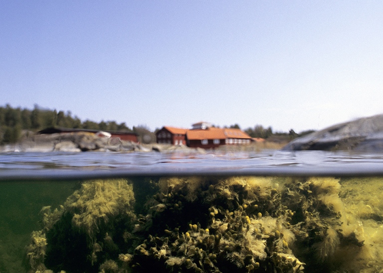
Knowledge about the oceans and seas is crucial for a sustainable use of marine resources. The demand for this knowledge is increasing globally, regionally and locally. Many companies and governmental agencies work with seafloor mapping and environmental assessments before installations are made on the seabed or along our coasts. The program in Marine geosciences is designed to meet the increasing knowledge needs about our oceans and seas, in society and within academic research where many questions related to climate change involve the blue part of our planet.
Quantitative skills and knowledge of chemistry and physics form an important foundation in the field of marine geoscience that are needed to work in the private sector or pursue an academic career. Mathematics, chemistry and physics are therefore included in the first year of the program.
Here you can read more about the bachelor’s program in Marine geoscience and about the courses you will study.
We hope you want to study with us!
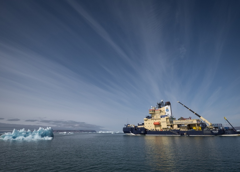
Study marine geoscience to understand the ocean’s role in the climate system
The ocean plays a key role in the climate system. Heat is transported through global ocean circulation patterns and without this transport we would be considerably colder in the Nordic region. The oceans also stabilize the climate through their enormous ability to store heat and absorb carbon dioxide from the atmosphere. Climate change has a major impact on the oceans, and this is also where the effects of global carbon emissions are most visible. In the bachelor’s program in Marine geoscience, you will study the role of the oceans in the climate system today and on longer geological time scales. You will learn about the development of the world’s oceans and seas during the Earth’s roughly 4.5 billion-year long history as well as about today’s challenges with pollution, algal blooms and zones of widespread oxygen depletion.
The sea is the future!
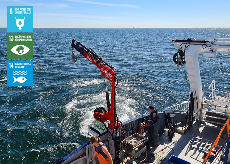
Global goals for sustainable development have been drawn up by the United Nations. Goal 14 Life below water underlines that how we manage our oceans and its resources is crucial for humanity as a whole and for balancing the effects of climate change.
Mapping methods
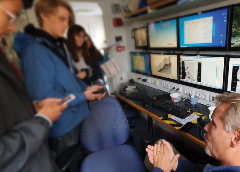
Practical skills in marine geophysical mapping methods are taught along with geological sampling and post-processing of collected data to produce digital maps, which describe the characteristics of the seabed and underlying sediments. You will also learn about the latest measurement methods for imaging wrecks on the seabed and actively help marine archaeologists find cultural treasures or the coast guard find shipwrecks.
Did you know that the bottom topography you see in Google Earth is compiled by researchers from the Department of Geological sciences at Stockholm University together with colleagues in an international project?
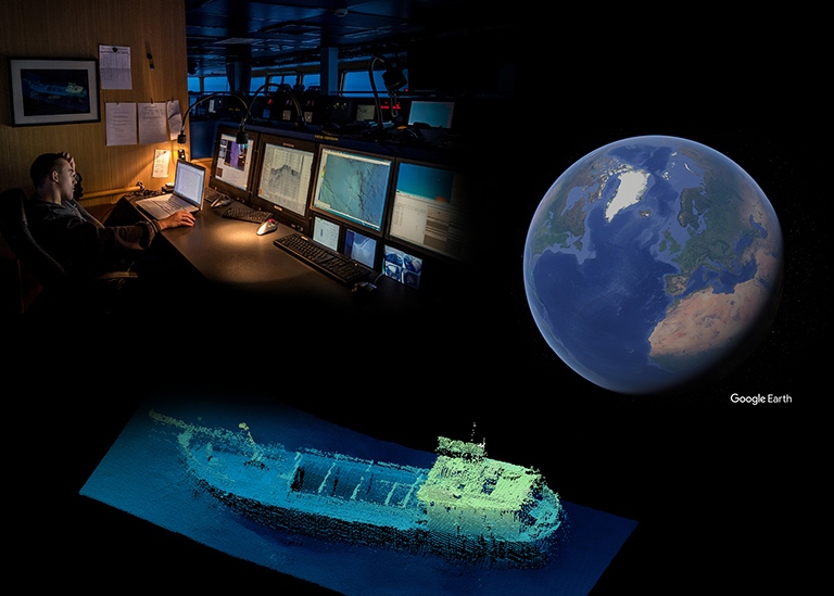
Lower: The wreck of M/S Marjaana, which sank in Lake Mälaren in 1969. The image was produced with the help of a multibeam echosounder.
Programme overview
Year 1
Compulsory courses:
Geological Sciences GG2010 (15 credits) Autumn term*
Mathematical Methods for Natural Scientists MM2004 (15 credits) Autumn term
Basic Chemistry KZ2012 (15 credits) Spring term
Physics for Geosciences FK3017 (15 credits) Spring term
Year 2
Compulsory courses:
Sedimentary Systems GG4208 (7.5 credits) Autumn term*
Oceanography for Geoscientists GG4090 (7.5 credits) Autumn term*
Paleoceanography and Marine Geology GG4216 (7.5 credits) Autumn term*
Submarine Geomorphology GG4070 (7.5 credits) Autumn term*
Marine Map-making and Geodesy GG4075 (7.5 credits) Spring term*
Marine Geophysics GG5125 (7.5 credits) Spring term*
Marine Geotechnics GG4076 (7.5 hp) Spring term*
Marine Geophysical Mapping Methods GG4071 (7.5 credits) Spring term*
Year 3
Elective courses (30 credit)
Marine Geosciences degree project GG6127 (30 credits)*
*The course is included in the main area of the education
• Course overview and course leaders
Geological sciences, 15 credits HT period 1–2
The course provides an exciting introduction to the earth as a system through lectures, practical exercises and excursions. Students learn about the processes that shaped our planet and made it habitable, plate tectonics and its consequences (earthquakes, volcanoes, tsunamis), how rocks are created and transformed through the rock cycle, stratigraphy (geological layers and deposits) and paleontology (fossils and the evolution of life), how the world’s oceans work, how geochemical energy is reused and transformed in ecosystems, and how humans affect the climate.
Field work on Gotland and Utö.
Course leader: Christophe Dupraz (Associate professor in Geomicrobiology).
Mathematical methods for natural scientists, 15 credits HT period 3–4
The course deals with basic mathematics and statistics of relevance to natural science subjects, such as differential equations and methods of statistical analysis, combined with an introduction to programming and computer calculations as well as computer algebra.
Kursansvarig: Håkan Granath (Assistent professor in Mathematics).
Basic chemistry, 15 credits VT period 5–6
The course deepens knowledge of chemistry from high school and provides a better understanding of basic chemical concepts. The course is designed to provide the foundation in chemistry needed to read our courses in marine geoscience, but also for studying further as a chemist, biologist, or nutritionist among other things.
Course leader: Lars Eriksson (Associate professor of Chemistry).
Physics for geoscientists, 15 credits VT period 7–8
The course builds knowledge of physics from high school and focuses in particular on the physics that underlies applications in geoscience. You will learn more about force, motion and energy, gravity, thermodynamics, waves and acoustics, optics, electricity and magnetism and fluid mechanics. The course contains practical exercises with experiments relevant to geoscientific applications of physics.
Course leader: Wolf Geppert (Professor of Physics).
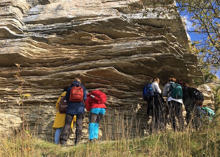
Sedimentary systems, 7.5 credits HT period 1
The course teaches you to recognize different types of sediments and sedimentary rocks and to understand how they were formed through sedimentary processes in different environments. The course covers the relationship between sedimentary rocks and plate tectonics, weathering, particles and particle transport, sedimentary structures and age dating. Both terrestrial (rivers, lakes, deserts, glacial areas) and marine (inland seas, coastal areas, deep seas) sedimentation environments are described.
Excursion to Västergötland.
Course leader: Malin Kylander (Associate professor in Sedimentary geochemistry).
Oceanography for geoscientists, 7.5 credits HT period 2
The course describes the circulation of the oceans and the dynamics that drive it. You will learn how the ocean basins affect circulation, about the properties of sea water, about basic atmospheric circulation and climate, wind-driven circulation in the ocean surface, circulation in the deep ocean, ocean waves, tides, sea ice and the connections between large ice sheets and the ocean. The course also provides an introduction to biochemical cycles in the world’s oceans.
Course leader: Agatha de Boer (Associate professor in Paleoceanographic modelling).
Paleoceanography and marine geology, 7.5 credits HT period 3
The course introduces the subjects of paleoceanography and marine geology. In marine geology, you will learn about the formation, structure and bathymetry of ocean basins, as well as about the crustal rocks underlying the oceans, the overlying marine sediments and their composition, and about the processes that control their deposition. In paleoceanography, you will learn how the circulation system of the oceans has developed in interaction with global climate during Earth’s history, and how microfossils and dating methods are used to reconstruct past ocean environments. A particular focus is placed on global ocean-climate development during the last approximately 100 million years.
Excursion: Excursion/field work may be included.
Course leader: Helen Coxall (Professor of Marine micropaleontology).
Submarine geomorphology, 7.5 credits HT period 4
The course deals with processes that shape the seabed and produce characteristic landforms on the bottom, and how these can indicate modern seabed dynamics and past environmental conditions. You will learn about erosion and deposition processes in marine environments, basic geomorphological concepts, and how different marine landforms can be mapped using marine geophysical methods. The importance of sea level changes, bottom currents and interaction between sea-bottoms and marine glaciers/ice sheets for the formation of submarine landforms are covered in the course.
Course leader: Sarah Greenwood (Researcher in Palaeoglaciology).
Marine map production and geodesy, 7.5 credits VT period 5
The course teaches practical skills in digital data processing, map production and analysis for geoscientific research and industry. The course deals with digital processing and presentation of geological, geographical and geophysical data. Students learn about GIS, geodetic datum, spatial databases, terrain modeling; modern positioning systems and Swedish and global reference systems for map making.
Course leader: Richard Gyllencreutz (Assistent professor in Marine geophysics).
Marine geophysics, 7.5 credits VT period 6
The course introduces the subject of marine geophysics. You will learn about the propagation of sound and sound waves in the oceans and various geological materials, the principles of sonar and seismic surveys of the oceans and seabeds, heat flow in water and sediments, the basics of navigation at sea, marine gas hydrates, the gravity field, the concept of isostasy, and the earth’s magnetic field. The course covers how different marine geophysical measurement methods and maps are used in practical applications in industry and research.
Course leader: Christian Stranne (Associate professor of Marine geophysical mapping and modelling).
Marine geotechnics, 7.5 credits VT period 7
The engineering properties of marine sediments are key parameters for offshore installations, and for understanding the physical, chemical and biological processes occurring at and below the seafloor. This course introduces students to geotechnical methods for characterising marine sediments. Students will gain practical experience in quantitative measurements for classifying different types of sediments, as well as the common approaches for measuring the strength, compressibility and permeability of marine sediments. Students will learn how to combine this data with results from sonar and seismic mapping to describe the subsurface stratigraphy, geological history, and engineering properties of an offshore site.
Course leader: Matt O’Regan (Associate professor of Sediment physical properties).
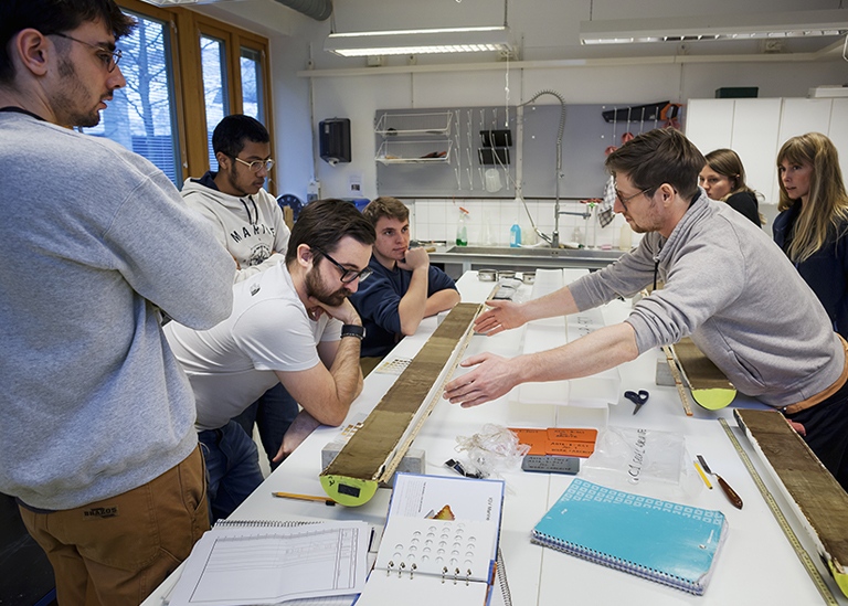
Marine geophysical mapping methods, 7.5 credits VT period 8
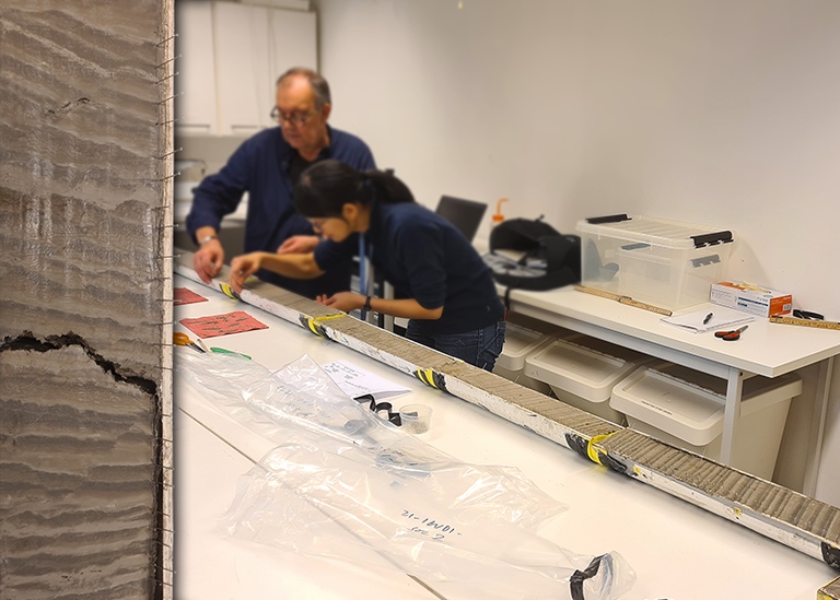
The course provides both practical and theoretical knowledge in marine geological mapping with geophysical measurement methods and sediment sampling. You will learn how sub-seafloor sediments and bottom topography (bathymetry) can be mapped using various acoustic measurement methods, including single- and multibeam sonar and side-scan sonar. The course also teaches marine geological sampling methods and includes practical exercises where you log and describe sediment cores as well as post-process and interpret collected marine geophysical mapping data. The course is directly adapted to provide professional preparatory knowledge in marine mapping methods.
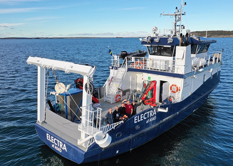
Excursion/field work with Stockholm University research vessel R/V Electra.
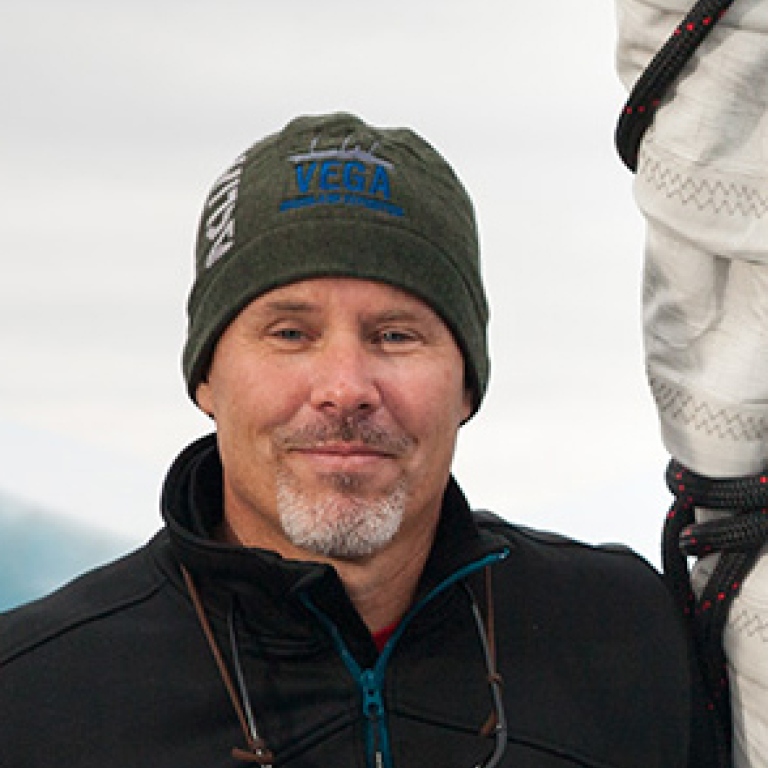
Course leader: Martin Jakobsson (Professor of Marine geology and geophysics).
• Some examples of what we do in the field and in the lab ...
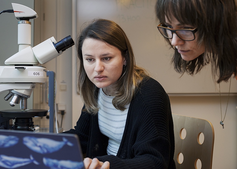
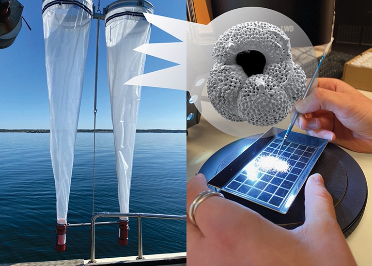
Within the program, students will discover that microscopic plankton shells preserve information about climate conditions thousands and millions of years back in time. Photo: Helen Coxall
After the studies
Meet some of our alumni.
 Photo: Privat
When I was studying, it was the courses on marine subjects that inspired me the most, so it’s great that there is now a whole program with that focus. I would definitely have chosen it if it was available when I was choosing a bachelor’s program.
Alexander Bäckström took a master’s degree with a focus on marine geology in 2018 at the Department of Geological sciences, Stockholm University. His independent work dealt with how satellite images can be used to estimate depth in shallow waters and how to compile this with different types of sonar measurements into a digital depth model. Today, Alexander works as a geologist at Sweden’s Geological Survey.
 Photo: Privat
We are currently looking to recruit marine geoscientific expertise as marine activities are increasing greatly and new areas need to be explored with the green transformation of our economy
Emma Sellén has a background in studies in marine geoscience and received her doctorate in 2010 at Stockholm University with a thesis that dealt with the oceanographic development of the Arctic Ocean. Today Emma works in Oslo for the company iSURVEY (part of the Reach Subsea Group, www.isurvey-group.com) where she leads marine-geological and geophysical surveys of the seabed. iSURVEY has particularly focused on minimizing the environmental footprint of installations and other activities at sea.
Come along!
We hope you want to study with us.
If you have questions please contact:
Student counsellor Elisabeth Däcker, elisabeth.dacker@geo.su.se
Director of BSc program on-site Richard Gyllencreutz, richard.gyllencreutz@geo.su.se
Last updated: October 11, 2023
Source: Department of Geological Sciences