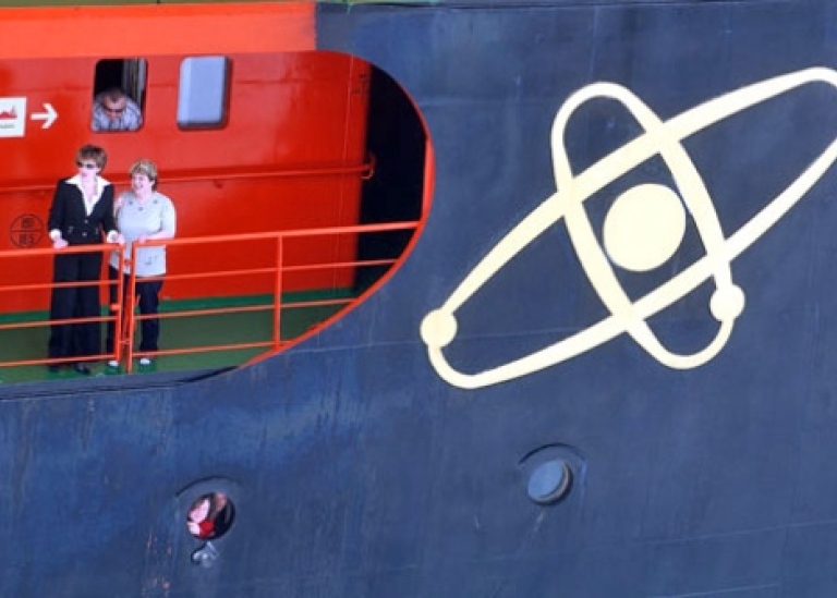
2007 | LOMROG Expedition
Follow icebreaker Oden on the LOMROG expedition 2007
August–September 2007
LOMROG departure from the "Gateway to the Arctic", Tromsö, Norway 2007-08-11
Oden arrived to Tromsö Aug 10 after the one month long Arctic Gakkel Vents (AGAVE) expedition. Led by Rob Reves-Sohn from Woods Whole Oceanographic Institution, AGAVE had focused on the volcanism in the Gakkel Ridge spreading center at more than 4000 m water depth. The new multibeam system installed on the Oden was extensively used to map small volcanoes to guide AGAVE's sophisticated underwater vehicles. These submersibles managed to take samples and photos from the underwater volcanic landscape. After crew and equipment rotation Oden departed with LOMROG from Tromsö at August 11 at 24h00.
2007-08-12: Bunkering in Honningsvåg, Norway
In Honningsvåg, Norway's northernmost village, fuel bunkering was made before leaving to go towards the Arctic Ocean west of Svalbard. The group of oceanographers from Gothenburg had not received their luggage in Tromsö, and arrangements were made to fly their luggage to Honningsvåg. However, SAS did not manage to locate the luggage in time before Oden had to depart in order to keep the schedule. Next chance was to fly the luggage to Svalbard.
2007-08-13: Transiting the Norwegian Sea
We passed Bear Island close enough to see its outline in the foggy weather. Sea was very calm allowing scientist to begin setting up equipments in lab and sampling gears on deck.
2007-08-14: Helicopter on deck
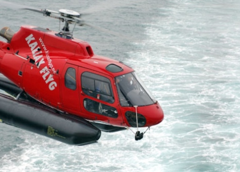
We passed Svalbard and picked-up our helicopter and pilot crew along with 11 pieces of extremely wanted pieces of luggage! Among this luggage was also scientific equipment, which now finally arrived safely. We will be testing equipment for the next day. The winds shifted to north and strengthened and we are running straight into the waves as we pass south of Svalbard. Temperatures are finally dropping and are currently below 5 degrees C.
2007-08-15: Testing of scientific equipment
Loose pack ice appeared and the wind and waves calmed down. We had to spool out the wires on both the coring and CTD winches in order to rewind them properly on respective winch drums. Since both have more than 6000 m wire, we aimed to do this in the Molloy Hole, which is the deepest location in the entire Arctic Ocean. This was also a target for our multibeam system test.
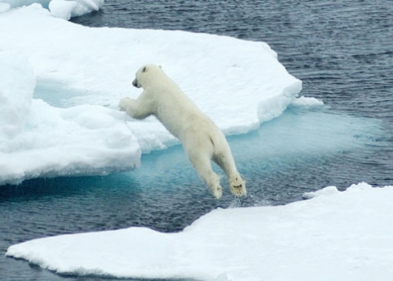
2007-08-16: Polar bears in the pack ice
We entered the pack ice early this afternoon and immediately spotted a polar bear. After this first bear encounter, another one turned up very close to the ship. Ice conditions are 8/10 with abundant cracks and leads with ice thicknesses around 1 meter or less. Oden was able to average over 5 knots most of the time.
2007-08-17: Rendezvous with the worlds largest icebreaker "50-years of Victory"
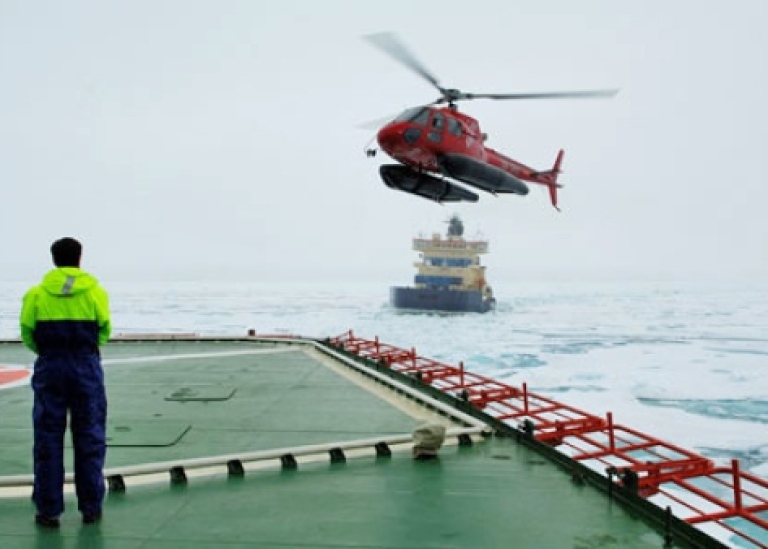
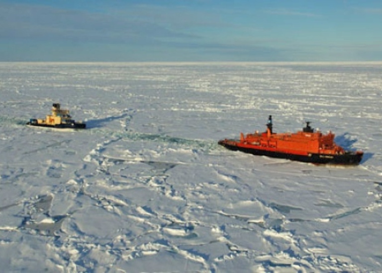
Contact was made at 10h30 UTC with the new Russian icebreaker 50 Let Pobedy, which means 50-years of Victory. This icebreaker has been contracted by the LOMROG expedition primarily to assist the Danish program to do seismic in heavy ice conditions. The Oden captain, Thomas Årnell, and expedition leader Anders Karlqvist from the Swedish Polar Research Secretariat, were the first to fly over with our helicopter to great the Russian icebreaker captain and crew. At 15h00 Oden and 50 Let Pobedy made the rendezvous at about 83°N, 10°E.
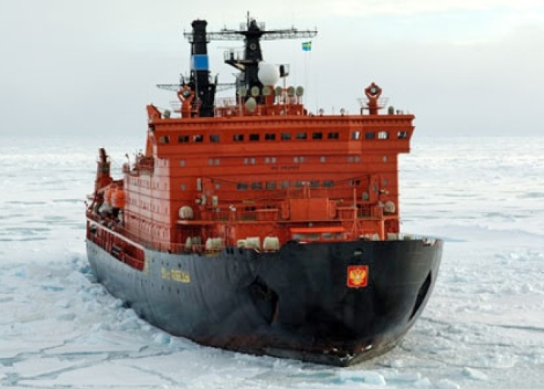
The icebreaker convoy could start towards the point where we plan to deploy the seismic equipment, 84°N and 10°E. What a ride through the ice! The 25 000 ton heavy 159 m long and 30 m wide nuclear driven icebreaker has 75 000 horse powers. We reached close to 15 knots at the most through the more than 1 m thick ice. This is much faster than I ever experienced before! There was a big celebration on board 50 Let Pobedy to commemorate the 30-year anniversary of the first nuclear icebreaker Arktika to reach the North Pole in 1977.
2007-08-18: Testing of optimal icebreaker configuration for multibeam and seismic measurements
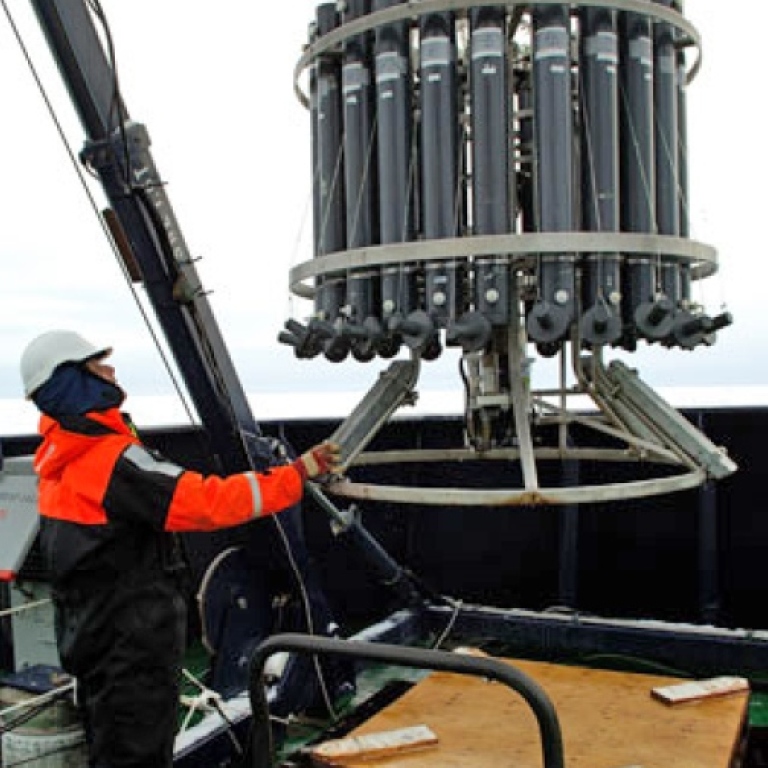
A couple of hours before reaching 84°, 10°E we slowed down to try out the optimal configuration between the two icebreakers in order to map with the multibeam and tow the seismic equipment. It turned out that the noise (the biggest problem for the multibeam) due to icebreaking could be kept to the minimum if Oden was going as close as 200 m behind 50 Let Pobedy in her wake. We got reasonably good multibeam data in this way. At 21h00 we stopped the tests in order to make a CTD (Conductivity, Temperature and Depth) station which will be used to calculate the sound speed in the water to calibrate the multibeam system. At this station, we also sent out people to work on the ice, both with gravity measurements and sea ice coring.
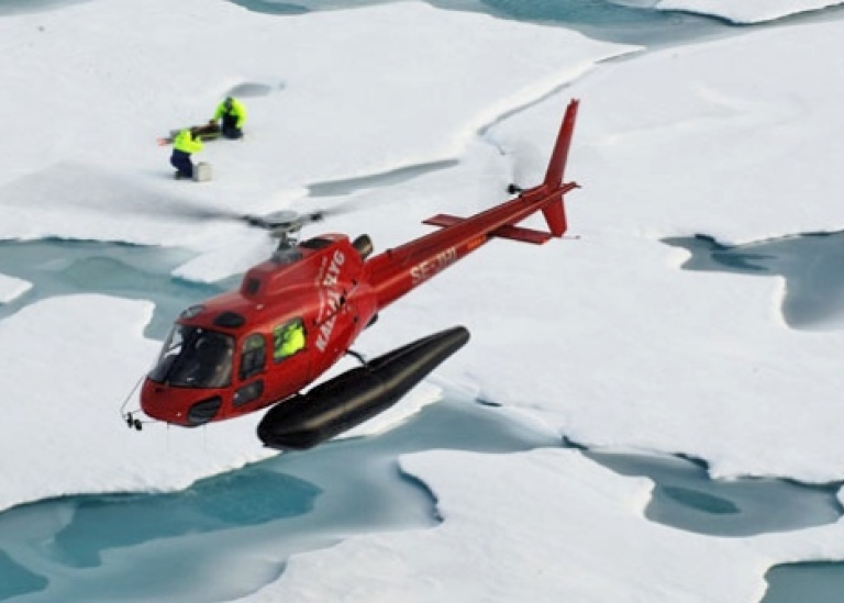
The Oden helicopter was sent to Tara, a French sailing vessel that has been frozen into the pack ice to do scientific experiments and measurements. Tara was drifting a bit more than 30 nautical miles away from our CTD station. They froze her into the ice near Wrangell Island, Russian Siberia, about a year ago and they have been drifting across the Arctic since. The concept was taken from Fritjof Nansen who froze the ship Fram into the pack ice near the New Siberian Islands and drifted across the Arctic Ocean between 1893–96. There are 8 people onboard Tara but not all of them have been there since the start. Our helicopter brought them a new instrument to measure ice thickness and some fresh fruit. Dennis Darby from Old Dominion University runs our sea ice sediment sampling project. He went with the helicopter trip to Tara and found a couple of nice "dirty" sea ice patches to sample for sediment.
2007-08-19: Seismic profiling and multibeam mapping
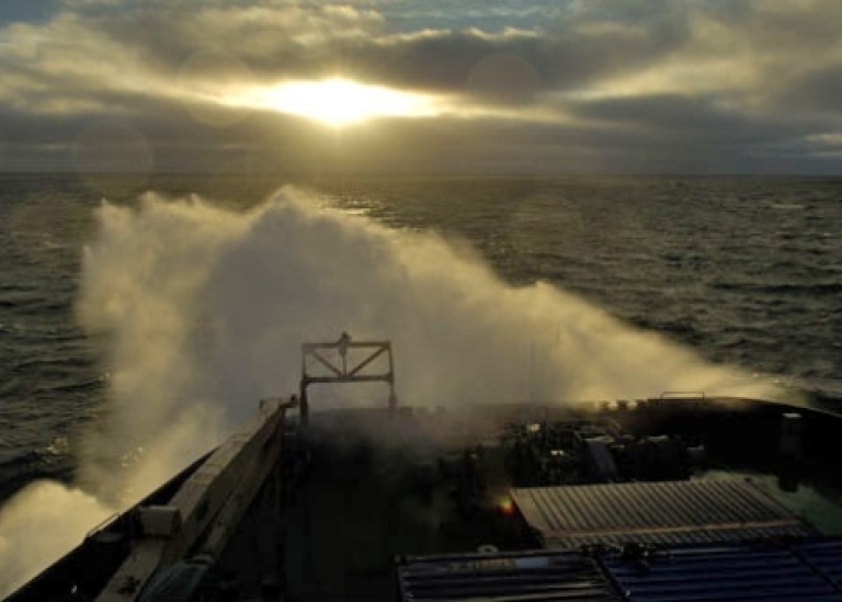
The seismic equipment was launched at 1.00 in the night. This was a very nervous moment for all that took part. It's far from easy to tow a 400 m long streamer (looks like a very long garden hose) and the seismic gun behind a ship where huge propellers spew out chunks of ice that can have the size of a car. The seismic guns fire out an acoustic pulse every 500 m which makes it possible to record the seafloor and see several kilometers of the sediment below. We are already in an area with very hard ice pressure and since we only can tow this equipment at maximum 4 knots, Oden gets stuck in the ice frequently.
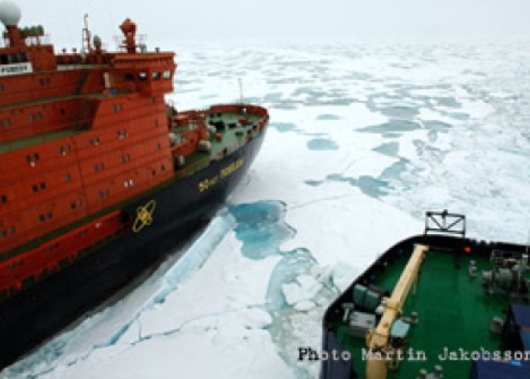
The Russian 75 000 horse power ice breaker has to break us loose at these occasions. Every time this happens we get to witness a great show in icebreaker maneuvering skills! At 14h30 Oden got a problem with one of the four engines and we had to stop for service and repair. We have gone through large areas with sediment laden ice. This is a great feast for Dennis Darby from Old Dominion University as his primary goal is to sample the sediment that drifts around in the Arctic Ocean with the pack ice. Around 02h30 the helicopter was dispatched with Dennis to sample dirty ice together with Katarina Gårdfeldt from Göteborg University.
2007-08-20: Another underwater mountain removed from the Arctic maps!
The outside temperature is just below freezing and the wind is moderate at about 5–6 m/s. The Oden engine problem has not been resolved yet, but we have decided to start moving forward with only three engines while they continue working on the problem. Ice pressure has decreased slightly during the morning although as we move more towards the west the thickness has increased instead! The icebreaker convoy started again after lying still for the engine repair at 10h50. The seismic acquisition has been going very well; the Danish team has probably recorded one of the longest profiles ever recorded in the central Arctic, and that is in very difficult ice conditions (10/10 coverage).
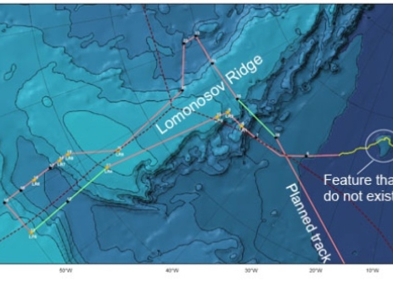
Their system is well designed for towing in heavy pack ice behind the Oden. We have targeted a bathymetric high sticking up 400 m above the otherwise more than 4200 m deep Amundsen basin. This submarine high shows up on the recently published Russian bathymetric map from 2001 as well as the earlier Arctic navigational charts. With the Oden multibeam we are able to see that this high does not exist at all! The abyssal plain is just flat at a depth of 4223 m every where we measure.
2007-08-21: Tough ice conditions and loss of the seismic streamer
The seismic equipment had been towing amazingly well for more than 130 km when a big chunk of the 400 m long streamer suddenly got loose to disappear into the deep Arctic. This happened at about 87°42' N, 11°W at 01h15 in the night where the ice conditions were so sever that the Danish crew decided to not deploy one of the spare streamers due to the risk of also loosing that. We continued without the seismic equipment towed behind. In the morning, we met with the Russian Captain to discuss the strategy for going through the extremely heavy ice ahead of us. The route was changed during this meeting to avoid some heavy multiyear flows and large pressure ridges. The decision was to take a more southerly course towards the Lomonosov Ridge than we originally planned. This really paid and at about 18h00 Oden was able to follow 50 Let Pobedy in more than 8 knots speed. However, this did not last to long!
2007-08-22: First sediment coring
Oden and 50 Let Pobedy reached the Lomonosov Ridge, which is the primary target for this expedition. The areas north of Greenland of the more than 1650 km long submarine ridge have never been visited by icebreakers due to the commonly prevailing tough ice conditions. No exceptions regarding ice conditions this year! We are faced with extensive pressure ridges stretching from northeast to southwest. One of the goals for the Danish program includes measuring the foot of the Lomonosov Ridge slope. This turned out to be difficult task in these severe ice conditions. However, if we progress very slowly and avoid the enormous amounts of crushed up ice directly behind 50 Let Pobedy, some bathymetric (depth) data can be collected with the Oden multibeam.
Several CTD (Conductivity, Temperature, Depths) and water sampling stations were taken by the oceanographic group lead by Leif Anderson and Göran Björk from Gothenburg University. These data will be used to characterize the Arctic Ocean water masses and circulation patterns. On a 1585 m deep part the Lomonosov Ridge crest we, the geology/geophysics group from Stockholm University, collect the first sediment core. The newly installed core handling system, which includes a large rail on the aft deck of Oden, worked very well and made the whole launching procedure so much easier than on our previous expeditions. Sediment coring in the Arctic Ocean involves clearing the area where the corer is going to be launched from ice, which at times may be very difficult. Are goal is to collect undisturbed sediment records where each layer hopefully contains information on the climate history, much like the pages in a book.
2007-08-23: Traces of the ice ages from the first ever mapping of the Lomonosov Ridge crest
The two ice breakers started mapping the sea floor of the Lomonosov Ride crest north off Greenland. Some very small leads existed in the otherwise compact and hard pack ice. This made it possible for Oden to carry out the multibeam mapping alone while 50 Let Pobedy could service their machinery. This actually improved the data quality significantly as 50 Let Pobedy leaves a nasty "ice slurry" in her wake that frequently prevents the acoustic signals from the multibeam and subbottom profiler. We worked along a profile from deeper waters towards shallower. At about 800 m, we found clear signs of erosion of the sea floor. Leonid Polyak from Byrd Polar Research Center and I immediately recognized that the sea floor in these areas have been impacted by glacial erosion. One of our main scientific questions can now be addressed: has immense ice shelves existed over most of the Arctic Ocean during previous glaciations?
Future analysis of the cores from this area together with the acoustic data we now collected should make it possible for us to finally answer this much debated question. CTD stations were successfully taken and some dirty ice patches could also be sampled by Dennis Darby and co-workers. As per every Thursday the evening meal on the Oden was pea soup and pancakes served with warm Swedish punch, not too bad!
2007-08-24: Successful coring for the glacial history
The late night/early morning started out with freezing rain and 8 m/s wind. The whole night was spent on mapping the Lomonosov Ridge to locate optimal coring sites. The idea was to take cores from the areas of the ridge crest at depths deeper than the glacial erosion as well as from the ice scoured areas. We started with coring the eroded areas and here we decided to use a short (6 m long) gravity core since, if our hypothesis holds up, we might encounter a stiff clay that has been reworked by grounded glacial ice, a so called glacial diamicton. This type of sediment is hard to core and there is a large risk of bending a longer corer. The coring turned out to be a major success!
We retrieved two gravity cores, 1.98 and 2.48 m long respectively. Both penetrated the uppermost sediment layers and into a stiff diamicton as predicted. A third piston core was taken at 811 m water depth, which is deeper than the glacial erosion. This 5.5 m long core seems to be a nice paleoceanographic record which may tell something about climate variations over longer time scales (thousands of years).
The day was ended with an unpredicted excitement, the fire alarm rang loud and clear at about 21h00. Everyone had to go out on the helicopter platform as rehearsed during the beginning of the cruise. This was in the middle of sauna hour for us that had been working on deck with coring, an inconvenient time for us to say the least! It wasn't "a false alarm", but not of a serious matter and we all could go back to our activities after the gathering. Exhaust fumes had been sucked into an open hatch.
2007-08-25: Transit in hard ice conditions
Oden and 50 Let Pobedy are in transit between the working area around 86°40'N to the southern most end of the Lomonosov Ridge at about 85°N. We got notification that 50 Let Pobedy may not be able to assist us during another 10 days as we requested. The reason for this is a damaged propeller on their ship which jeopardizes their as well as our operation in these extremely tough ice areas we are operating in. We will get a definite answer by Monday 27, when we can discuss the matter with the CEO of Murmansk Shipping Company. We decide to steam ahead as fast as possible, which is far from fast, to the southern Lomonosov Ridge so we can get to the point where the Danish program have planned to start collecting their seismic data. Every time Oden get stuck 50 Let Pobedy takes a loop around and breaks us loose. The power of this giant icebreaker is certainly amazing and absolutely necessary to operate where we are.
2007-08-26: Start of seismic acquisition from the south eastern tip of the Lomonosov Ridge
We reached the point where the Danish project could start acquiring their seismic line. While the seismic equipment was prepared the oceanography group lead by Leif Anderson and Göran Björk from Gothenburg University took the opportunity to take a CTD and water sampling station. This will provide information on the present Arctic Ocean circulation and water mass properties and since no one has been operating in this area before, all new data may bring surprises!
Launching of the seismic equipment went very well around 15h00, but the ice was very thick with abundant pressure ridges and to keep a straight line without stopping was extremely difficult for the two icebreakers. Initially towing of the 400 m long seismic hydrophone streamer worked fine despite that the wake behind Oden was full of ice due to the large ice pressure. A large ice pressure has the tendency to close the wake behind the ship very fast. In turn, the ice pressure depends on the air pressure, wind and resulting ice drift. A couple of hours after dinner, the streamer got caught by ice and a large chunk of it was lost to Neptune. The Danish team replaced the lost section and continued their data acquisition, which will tell them the geological structure of the Lomonosov Ridge.
2007-08-27: Heroic rescue of seismic streamer stuck in the pack ice
At about four a clock in the morning the seismic streamer got stuck in the ice that closed up in the wake behind the Oden. We could see the streamer pinched and entangled around extremely large blocks of ice. It was decided to attach a rope around the streamer and try to pull it loose using the helicopter. The helicopter pulled on the streamer for nearly an hour while 50 Let Pobedy drove very close in attempts to break nearby leads to release the ice pressure. Despite some very skillful maneuvers by the helicopter pilot and the Russian ice breaker captain and his mates, the streamer did not want to come loose. The rescue maneuver was finally called off. But our Russian companions did not want to give in and offered to try pulling out the streamer with the ship. This required extreme skills as 75000 hp easily could snap a streamer or at least stretch it out like a rubber band. But the rescue succeeded and parts of the streamer could be saved. After breakfast Anders Karlqvist, the director of the Swedish Polar Research Secretariat, talked with the CEO of Murmansk Shipping Company. The damage of 50 Let Pobedy's propeller prevents them for extending the lease period since the ship is still under warranty from the manufacturer and the warranty will not be valid if Podeby operate in these ice infested areas north of Greenland with a damaged propeller.
However, we must consider the expedition a huge success so far even if we cannot continue and make a transit over to the Greenland shallow shelf. We reached the Lomonosov Ridge off Greenland and mapped the sea floor and took samples from previously unexplored areas - the goal of the expedition! We will now move on towards Morris Jessup Rise where we have more scientific targets planned. After the stop of seismic acquisition due to the loss of the streamer we decided to take a core. An accident seldom comes alone. The old coring winch (the oldest piece of equipment on board the otherwise modernly equipped Oden) got a sudden hydraulic oil leak and half the oil leaked out on deck. After this was repaired, the winch broke down completely due to an electrical short in one of the magnetic valves that steers the hydraulics. It looked really bad, what could we do without a winch?
2007-08-28: Transit to Morris Jesup Rise
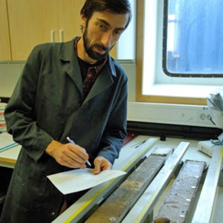
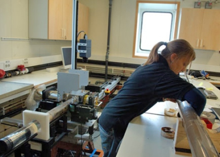
After the coring winch broke down we began our transit towards Morris Jessup Rise together with 50 Let Pobedy. Several helicopter flights were made to the Russian ship and the transit route was discussed between the captains. The helicopter was also used to do ice reconnaissance flights but bad visibility prevented longer flights. Daniela Hanslik, Ludvig Löwemark, Emma Sellén, and Åsa Wallin from Stockholm University were busy in the sediment lab logging the cores we retrieved so far using our Multi Sensor Core Logger (MSCL).
This logger measures density, p-wave velocity, and magnetic susceptibility; parameters that vary depending on the sediment physical properties. The produced records provide useful information on environmental changes that caused changes in sedimentation. Chief Engineer Dan Skantze had narrowed down the problem with the coring winch and come up with a solution. He rebuilt a new magnetic valve and installed it. When the winch started again and worked, we all were mighty impressed and pleased! It meant that we could go for more cores and we still had a chance to take one of the Lomonosov Ridge slope.
2007-08-29: Sun in the Artic
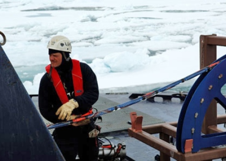
The day started with clear sky and sun. It was the first time after a long period of gloomy weather with poor visibility. The Danish team doing gravity and ice work managed to make good use of the superb flying conditions. Rene Forsberg from the Danish Space Center and Hans Ramløv from Roskilde University Center run a sea ice program where they frequently fly out with Oden's helicopter to measure the ice thickness around the ship. Today they measured thicknesses of floes up 3.7 m. If one adds to this the sea ice pressure ridges that may extend much more than 10 m below the sea surface, it's not hard to understand why it's so difficult to operate in this part of the Arctic Ocean. Meanwhile we received a report from Larry Mayer from University of New Hampshire, who is using the US Coast Guard icebreaker Healy to map north of Alaska, that they have hardly any sea ice at all.
2007-08-30: Transit to Morris Jesup: Part II
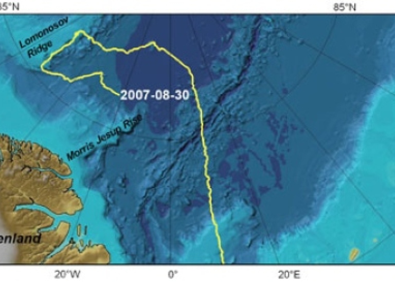
It goes slowly, but we do make progress at an average speed some where around 3 knots. Even 50 Let Pobeda gets stuck at times so she has to back up and ram the thick pressure ridges we frequently need to pass. When Oden is getting stuck in Pobeda's (that is what we call the ship) wake due to all the crushed up blocks she leave behind, they turn around, make a big loop and cut right in front of us to break us free. We all hope to find easier ice conditions soon, further to the east!
2007-08-31: Pirouette surveys of the Morris Jesup Rise
This was the day when 50 Let Pobedy had to depart from us to go back to Murmansk. She certainly departed in a ceremonial style, passing us very close while playing out load Russian classical music. It has been a good two weeks of collaboration between the two icebreakers. We continued moving towards the northern steep slope of the Morris Jesup Rise, where the Danish project has as a goal to map the foot of the steep slope. A new style of multibeam mapping was invented, which proved to be very efficient in tough ice conditions.
When Oden is breaking heavy ice using all her 25 000 hp we do not get much depth information from the multibeam, only some pings here and there passes through the noise and crushed up ice. To get some good depth data we need either to break as gently as possible or break a ship length, then back up while measuring the seafloor with multibeam during the backing. This is very time consuming. Instead we found that we could break through the ice along our intended track until we found some smaller cracks or openings in the ice where we could spin the icebreaker 360 degrees while collecting data. In this way we efficiently covered the seafloor around us with a radius equal to the multibeam swath. For example in 4000 m we could, during the most favorable conditions, measure with a radius of more than 10 000 m around the ship. Our mapping soon showed that the northern slope of Morris Jesup Rise was wrongly placed on available bathymetric maps and also incredible steep.
2007-09-01: A glacial landscape at 1000 m water depth
The shallow crest of the Morris Jesup Rise was reached after mapping the steep slope. The first goal was to take a piston core from an area where neither bottom currents nor icebergs had disturbed the seafloor sediments. The multibeam and chirp sonar subbottom profiler provided the critical information we needed to select such a coring site. Just when the old coring winch seemed like it was going to behave; the remote control unit decided to start a fight by only letting us take in wire, the outhaul stopped working! That is kind of critical when we first need to haul out wire to get the corer down to the seafloor!
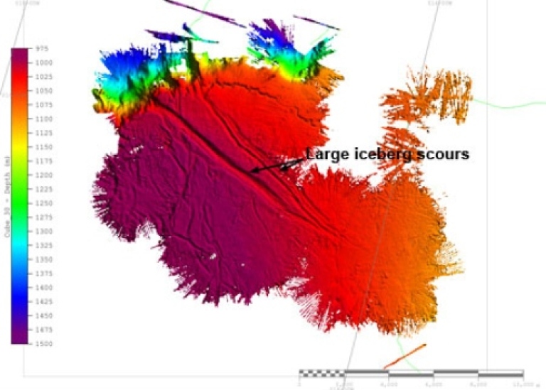
Per Frejvall, responsible for IT and logistics from the Swedish Polar Research Secretariat, opened the winch's control unit and some loose pieces fell out. Not good! Coring operation stopped and to not waste any valuable ship time we decided to take water samples and a CTD, which was quickly launched by the oceanographers. However, after some searching the spare control unit was found and we could take up the coring, after the CTD station was finished. While the coring crew was struggling on deck, the planned "Crawfish party" was well under way in the nice and warm atmosphere inside the Oden icebreaker. But finally we got a good core containing a record of undisturbed sediments, which made all the work worth while. Multibeam mapping was next on the list, and it did not take long before absolutely beautiful giant iceberg scours appear on the multibeam computer screen at water depths as deep as 1050 m. These scours have been formed by large icebergs that calved off Arctic glaciers during previous ice ages. Today none of the existing relatively small glaciers produce icebergs that reach below approximately 100 m water depths in the central Arctic Ocean.
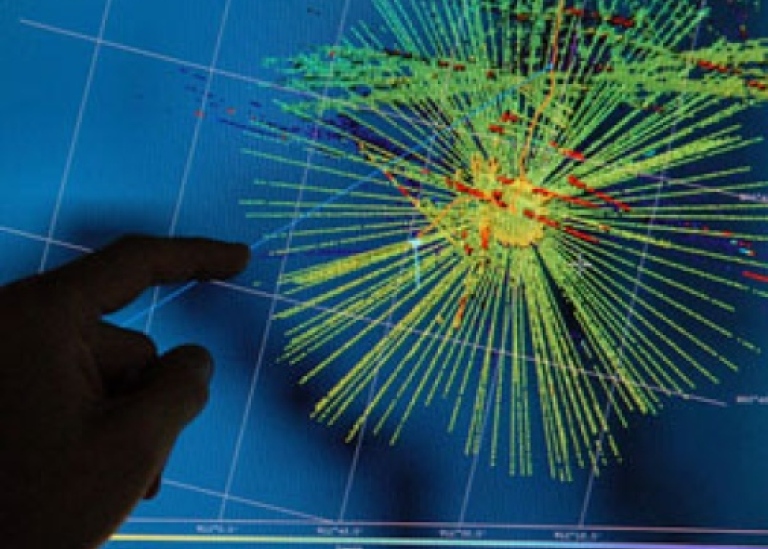
2007-09-02: Amazing multibeam data
The northern plateau of Morris Jesup Rise was covered by more and more multibeam data as we crisscrossed with Oden to make occasional stops for a 360 degrees pirouette. Shortly after the data was acquired, post processing begun. The detailed image that emerged provided all information needed to locate some coring sites for different scientific purposes. We planned to take two cores in the largest iceberg scour so we could get material for dating the ice scouring.
2007-09-03: Coring an iceberg scour
The weather has changed to colder temperatures (-2 to -5 deg C) and we are starting to see that the Arctic summer is soon over. After the careful multibeam survey of Morris Jesup Rise's "glacial landscape" we had a good idea of where to place our sediment coring sites. One of the main scientific questions is when the largest iceberg scours were carved in the seafloor – Was it during the last ice age that ended at about 10 000 years ago or earlier? To date the deepest scours we need sediment cores from them. This will allow us to find out how much sediment that has been accumulated since the scouring event. In other words, dating of the first sediment that accumulated on top of the scour will tell the age of the scour. To hit right in an iceberg scour with the sediment corer is not at all easy since the ship drifts with the sea ice while we lower the corer. Benjamin Hell from Stockholm University took great pleasure in the challenge of calculating the exact position for the ship when the corer was going to be launched. To hit the target he needed to know: the ice drift speed and direction, the depth at the coring site and the winch speed (this we could modify to some extent). To cut the story short: we succeeded to hit the target within 50 m which must be considered a great success! After two cores were taken in the largest iceberg scour, we ended the work on the shallow part of the Morris Jesup Rise and started to map its steep eastern slope.
2007-09-04: An oceanographic transect across the Fram Strait
At the extremely steep eastern slope of Morris Jesup Rise, the oceanographers became very busy as they started their station work along a planned transect, which ends first when we reach the Gakkel Ridge. Their plan was to have less than 20 nautical miles between the stations.
They had to work around the clock in shifts to achieve this ambitious goal. We aim to end the oceanographic transect at a very high "pinnacle" in the Gakkel Ridge. According to echo soundings from US submarines, the pinnacle should stick up more than 3000 m from the surrounding deep abyssal plain. If the data are correct, it must be a part of the Gakkel Ridge created through the volcanism near the spreading center. In a few days we will know how good the echo sounding data from the submarine is here, and if the pinnacle exists we hope to find undisturbed sediments to core on the top.
2007-09-05: Oden breaks hard ice
Oden continues the oceanographic transect, but the progress is only at a couple of knots speed due to hard ice. Our new time estimate suggests that we will reach the mysterious Gakkel Ridge peak first during Friday 7th. In the core lab, the coring group is logging, opening and describing the cores we took at the Morris Jesup Rise.
2007-09-06: Polar bear close to the ship
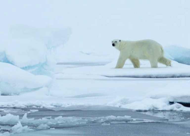
The group that study sea ice was lifted of the ship with the crane today so that they could measure the thickness of nearby ice floes. We are getting into areas with lighter ice, but the flows are still around 1.8 m thick and some occasionally more than 3 m. But Oden manage very fine in this type of ice conditions and we are sometimes moving in as much as 7 knots. Sometime after the ice work was completed and all were safely on board the ship, a polar bear was spotted very close to us. This is the first one spotted since we entered the pack ice several weeks ago.
The temperatures are finally beginning to drop more dramatically today with -5 to -6 deg C. Winter is not far away in the Arctic!
Expedition report
 LOMROG I, Lomonosov Ridge off Greenland 2007 (8035 Kb)
Lomonosov Ridge off Greenland 2007
Last updated: May 20, 2022
Source: Department of geological sciences