This is Martin Jakobsson's Log
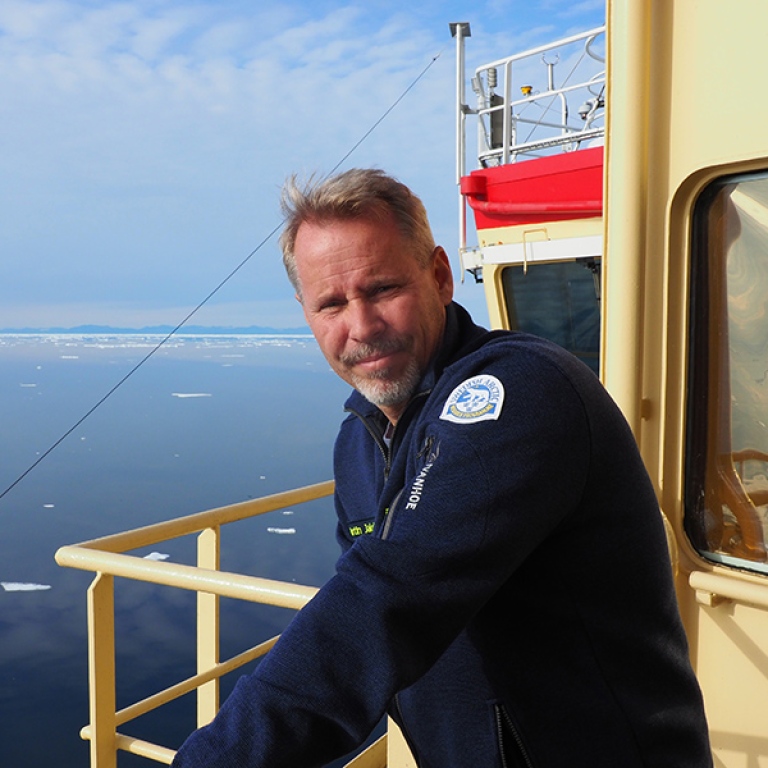
Martin Jakobsson | Co-Chief
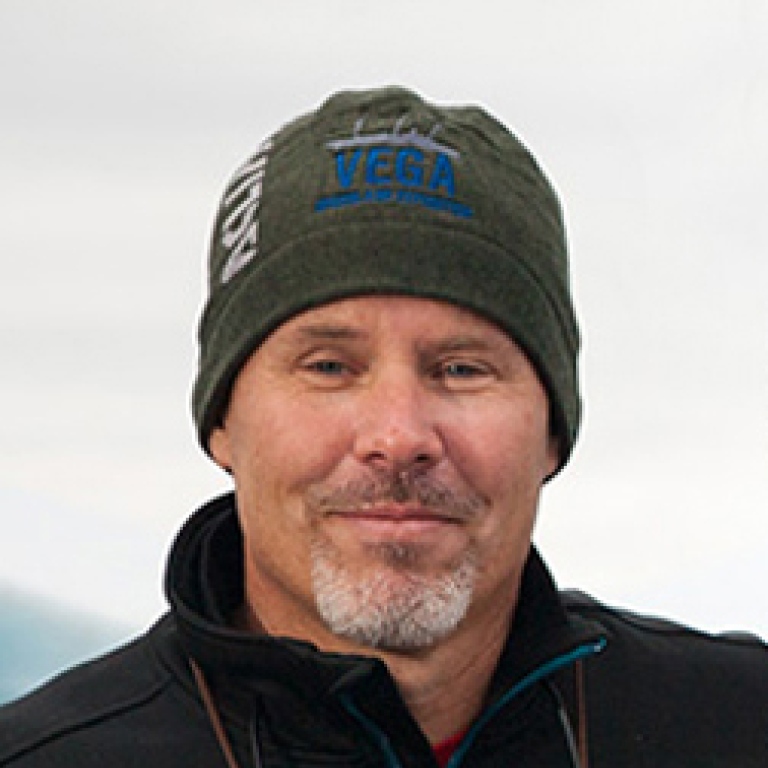
Martin Jakobsson is a Professor at the Department of Geological Sciences at Stockholm University and co-chief of the expedition. He is supported by Swedish Research Council (VR) and The Nippon Foundation
(All photos are taken by Martin.)
August 6 | Nares Strait
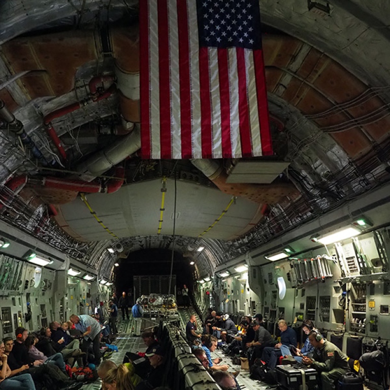
The Ryder 2019 Expedition started August 5 from Thule Airbase on Northwest Greenland. All scientists and ship crew flew to Thule Airbase from Newburg in New York with a huge US Airforce C17 transport plane. It was a smooth but noisy flight, either earplugs or noise cancelation headphones was a must! Using Thule Airbase as a starting point when targeting Northern Greenland, as our Ryder 2019 Expedition, is advantageous because it makes the transit short. But it requires access to the US infrastructure at the base. Our American colleagues and the Swedish Polar Research Secretariat’s collaboration with US National Science Foundation (NSF) made this happen. When we arrived at Thule, icebreaker Oden was waiting outside in the fjord. Oden had been in the Northwest Passage in the Canadian Arctic for an NSF expedition. The ship crew that worked on that expedition was now going to be rotated here in Thule.
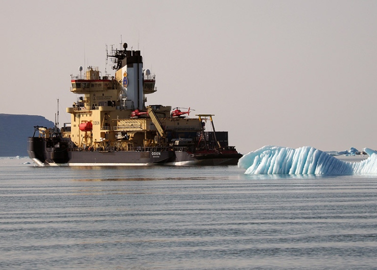
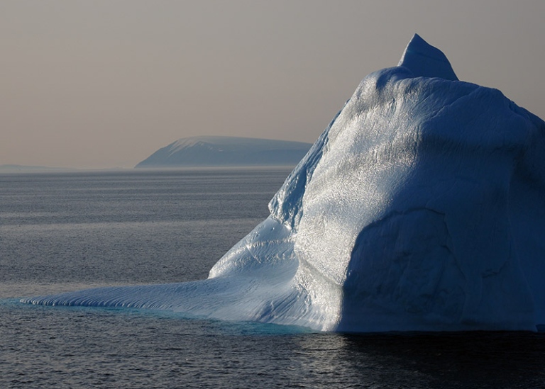
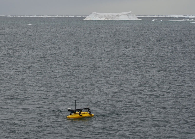
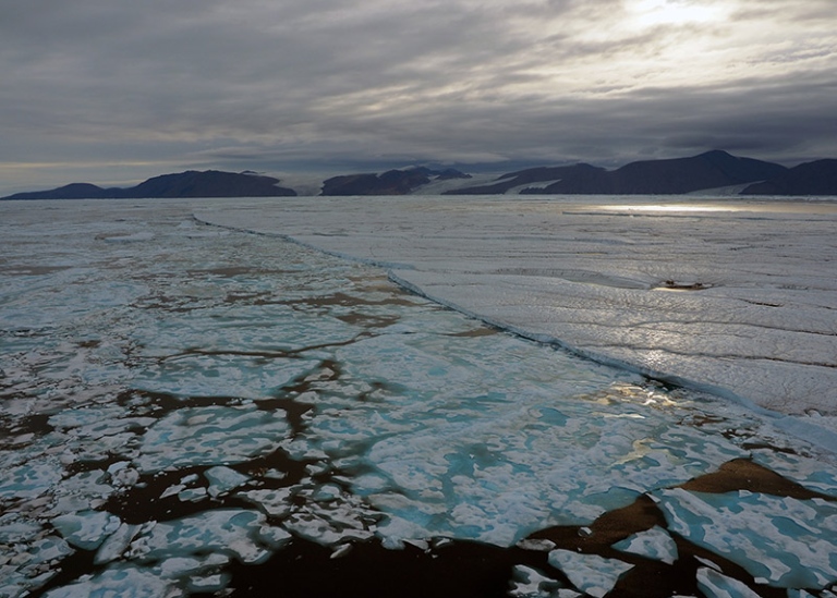
We went directly from the plane to the ship, and it did not take many hours until Oden took up the anchor and we began steaming up north through Nares Strait. It is as always amazing to meet the icebergs coming from the Humboldt Glacier and other outlet glaciers further up north along Nares Strait. We have studied the ice conditions intensively in satellite images over the last days. Right now it looks rather good to go all the way up to the northeastern part of Ellesmere Island, that is to the very end of Nares Strait. Our prime target is the Sherard Osborne Fjord where Ryder Glacier drains a part of the Greenland Ice Sheet. This fjord has never been surveyed before, in fact no ship has entered here at all. Sherard Osborne Fjord is located about 115km from the northeastern tip of Ellesmere Island. Our plan is to fly by helicopter to the entrance of Sherard Osborne Fjord to make a survey with a radio controlled, about 1.7m long, vessel called the “Echoboat”. It has an installed multibeam sonar that measures seafloor depth. We need to know if the entrance to the fjord is deep enough for Oden to enter. The fact that there is no information of the seafloor depth in the Sherard Osborne Fjord together with commonly very difficult sea ice conditions makes the Ryder 2019 Expedition challenging mission! We should be at the northeastern tip of Ellesmere Island in a couple of days.
August 7 | Bessel Fjord
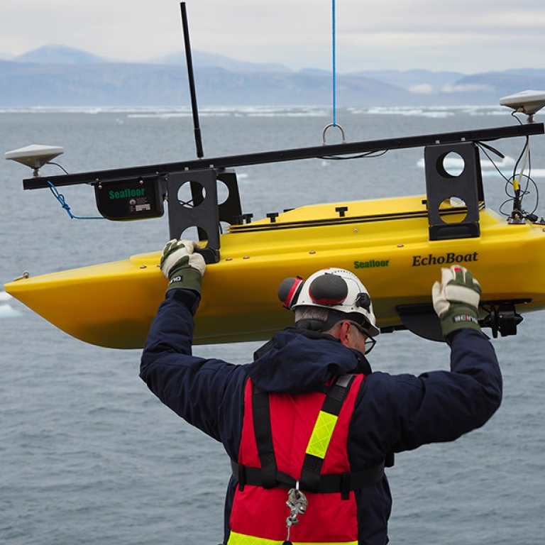
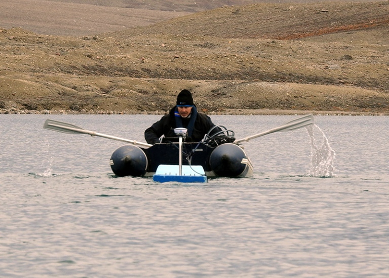
We arrived to the entrance of Bessel Fjord at about lunch time. This is the fjord just due south from Petermann Fjord where we worked with Oden in 2015. It has taken us a third of the time it took four years ago to get here from Thule since the ice conditions have been much lighter this year. Oden has been able to go in 10 knots instead of the 2–4 knots that are possible keep in a couple of meter thick ice with a few open leads here and there. One of the main point in the plan of today consisted of testing the small “EchoBoat”. Larry Mayer’s team from UNH are the specialists onboard on these kind of remotely controlled mapping devices.
Our plan is to take the small EchoBoat to the Sherard Osborne Fjord Entrance where Ryder Glacier drains. We will bring the boat with helicopter and then map a large enough part of the entrance so we can enter. There is small island in the fjord entrance where we plan to land there and drop the Echoboat in the water, if it is possible and the shores are not too steep. This will be a challenge!
August 8 | The Hut on Nyboe Land
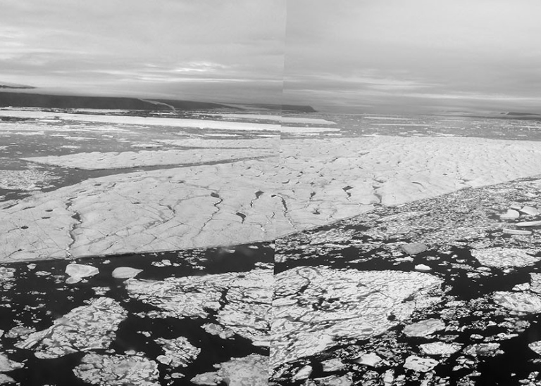
We have begun systematic mapping with Oden’s multibeam echosounder, sub-bottom profiler and midwater sonar. With these instruments we create a detailed map of the seafloor bottom topography, the upper ca 50m of sediments below the bottom and features in the water, for example pronounced temperature changes, rising gas bubbles from the seafloor and fish as well as plankton. The area we work in is located northeast of Ellesmere Island. We benefit from a rather large open polynya created here meaning only some flows of sea ice in the most open parts. The data will help us understand the glacial history, in particular the part following the last glaciation when ice sheets expanded out from Greenland and Canada. Their retreat back to the present size and position have left traces in the seafloor. The goal is to take sediment cores in this area tomorrow.
As soon as the weather permitted we made an ice recognizance helicopter flight toward the Sherard Osborne Fjord. The sea ice in this northern part of Nares Strait can be extremely difficult to deal with. It is commonly characterized by a rather strong southwesterly drift, and mixture between really old thick ice and some younger thinner ice. But it looked like there are sections with enough crushed up ice in between the large older flows, so it should be doable to cross to the Ryder glacier area.
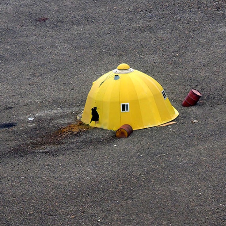
When we flew over Greenland cost towards Ryder we saw an abandoned hut with a torn up hole in one side. Near the hut were old rusty oil barrels, and some kilometers away we saw a fundament of something looking like a small cabin. Is all this trash left behind some earlier science expedition, or who else would come this far up? Hunters? Military? In any case, the trash should of course not have remained. The area here is otherwise rather untouched by modern man, it must be one of the most remote and wild places on Earth.
August 11 | Fighting ice towards Sherard Osborne Fjord
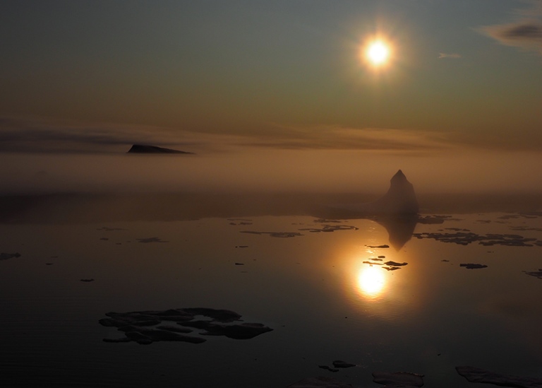
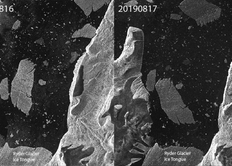
The Ryder Glacier drains into Sherard Osborne Fjord. There are two small islands located in the middle of the main fjord entrance and one larger called Castle Island in the western part. No names exist on the smaller islands on our maps. We made a helicopter flight to check out the ice conditions and if there were an optimal way to get into the fjord. A huge iceberg originating from Ryder’s floating tongue practically blocked the entire 9km wide entrance between the small islands in the middle and Castle Island in the western part. It has moved out from the inner fjord in a few days, in fact the icebergs in the fjord move around quite a lot. It seems to be in a circular pattern, they flow in along the western side and out along the eastern. I have studied satellite images back in time, and these icebergs have been in the fjord at least since 2016. I will go back and check exactly when the calved once back home when I have access to internet and can download a lot of large satellite images.
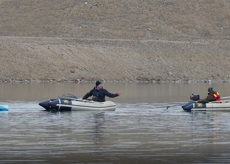
While we made the helicopter recognizance flight, station work was completed on Oden. So far we have taken 2 gravity cores, 3 CTDs and plankton sampling stations. After all work at the station was completed, we begun the route towards Sherard Osborne Fjord. It turned out to be a shaky and noisy night because Oden had to work very hard to get through the heavy ice on the way.
August 14 | Into uncharted waters!
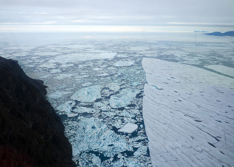
Time to go into the Sherard Osborne Fjord! We need a strategy how to accomplish this challenge. First, the large iceberg (size: 3.8 x 7.8km) next to Castle Island in the western side of the fjord mouth almost entirely blocks that entry. There were on the other hand no big icebergs from the ice tongue east of the two small islands in the middle of the fjord mouth. We decided that going through this eastern side would be our chance to enter. It felt magical to slowly break in through the pack ice and navigate between medium sized icebergs, or actually rather large icebergs, but not in comparison with the giants from the ice tongue of which some approach 10km in length. The seafloor in Sherard Osborne Fjord is completely uncharted. Where big icebergs have passed, we can however be sure that it is deep enough for Oden, which has a draft of 8m. I have tracked icebergs in the fjord several years back in satellite images, but only the bigger bergs and they seem to go on the western side of the two small islands. This means that we must find a way to also map ahead of Oden. In 2007 during the LOMROG (Lomonosov Ridge Off Greenland) expedition, we came up with a technique to map with Oden in 100% ice covered waters. We found that if a small area is broken up, Oden is capable of rotating more or less on the spot while collecting depth measurements with its multibeam echosounder. The multibeam maps the seafloor over an area underneath the ship that extends to approximately 2 times the water depth on each side. The technique we came up with became known as “pirouette mapping”. Using this approach we can see out to the side of the ship. If it is for example 400m deep, we can measure depths to approximately 800m away from the ship on each side. We applied this technique and rotated Oden when entering Sherard Osborn Fjord. After depths were collected in front of us, the the ship was moved forward as far as we mapped, and rotated again. It took time, but we got into the fjord by the evening of August 11! We have reached the goal of entering Sherard Osborn Fjord, now it is time collect as much data as we possibly can! But before doing this, our Captain Erik Andersson wisely wanted to map the other possible exits out of the fjord, in case we will need to go out fast for one reason or another. So we began with a comprehensive mapping program.
August 15 | Lake Mapping
The “Land Team” as we call them, has now been camping for nearly a week close to two lakes on Warming Land. This piece of land is located west of Sherard Osborne Fjord where the Ryder Glacier drains and where we are working with Oden. One of their missions is to take sediment cores from one of the lakes. The cores will be analyzed for DNA-content with the idea that different sediment layers will provide time snapshots of information on the fauna and flora. This is possible if samples are taken at different levels in the sediment cores that later are dated. If for example muskoxen walked down to the lake to drink, they likely used the area around the lake as a toilet or left some wool on the ground. DNA from their remains will spread to the lake and end up in the sediments. Analyzes of DNA in sediment samples have an enormous potential to provide new information. Love Dalén and co-workers are setting up a brand new facility at Stockholm University for analyses of ancient DNA. We have also discussed collaboration on our marine sediment cores. Ships are the best catalysts for cross-disciplinary collaboration!
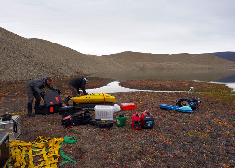
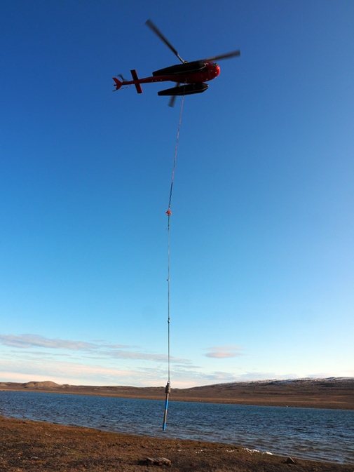
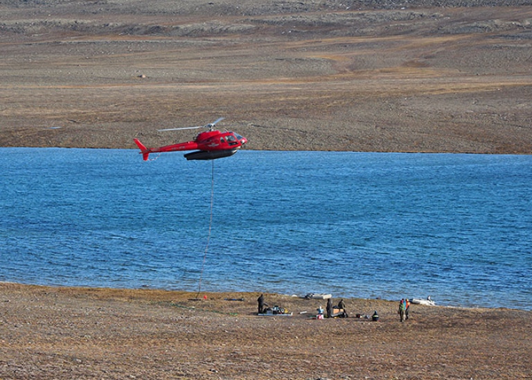
I was asked by the lake coring operation group, led by Dan Hammarlund who has lots of experience from coring lakes, to come up to the camp with my small portable sub-bottom profiler and survey the lake. In addition, the remotely operated EchoBoat could be brought along to also map the lake bathymetry. Larry Mayer, Kevin Jerram and Sam Reed from UNH agreed that this was a perfect application for the EchoBoat and decided to take on the mission. All of us flew up with the helicopter with our equipment for a “Lake Mapping Mission”.
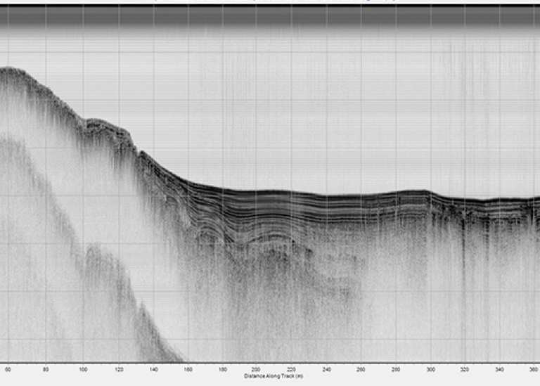
We setup the systems at the lake shore. It did not take long time until both the sub-bottom profiler and EchoBoat were in operation. I used a rubber boat to tow the sub-bottom profiler behind me mounted on my “home-made” towing device. It was most likely a rater funny sight to see me rowing, sitting on the floor of the rubber boat with all electronics around, or at least they laughed a lot on the shore and filmed. After rowing four ca 450m long profiles along the lake, I was rather exhausted, specifically since I tried to row in a steady pace. By the time I regained breath after the fourth profile, they called on the radio that the small 2hp outboard motor was now working. Since there was no space in the small rubber boat to sit in front of an outboard motor, we decided to launch the second rubber boat they had available in the camp with Larry as an operator to tow me behind. This worked fine, except for that it was rather difficult to steer, even more amusing for all looking at us. We circled around each other for a while until we got the caravan going. At the end of the Lake, Larry could not turn and fiddled with the throttle so we run into the shore. Luckily they did not see this from the shore on the other side, they might then have fainted from laughter. We accomplished two things, 1) logging some absolutely stellar sub-bottom profiles 2) entertaining all that watched us from the shore. I suspect the film of the rubber boat operation will be shown at some department party sometime in the future so all can get a good laugh, I must admit it looks ridiculous, but we gathered data.
August 21 | Icebergs with bad behaviors!
Ever since we got into the Sherard Osborne Fjord we have kept track of all the large icebergs that calved from the ice tongue of Ryder Glacier. Not sure if I explained what an ice tongue is, so here comes a brief explanation. Ice sheets, like the one on Greenland, are divided into drainage areas much like a terrain is divided into a drainage areas based on how water from a catchment drains in a network of rivers and streams downhill to lakes and eventually the ocean. The configuration of high terrain and mountains divides a terrain into drainage areas. “Ice streams” are fast flowing streams of ice analogues to rivers/streams. Where these ice streams reach the ocean, they are called “tidewater outlet glaciers”. They can terminate in two different ways:
1) Abrupt in so called “ice cliffs”, where irregularly shaped icebergs are calved from the margin directly into the ocean;
2) In a floating “ice tongue”, also called “ice shelf”.
The word ice tongue is typically used for floating extensions of tidewater outlet glaciers in fjords, while ice shelves commonly are wider and unconstrained by fjords, like in Antarctica. A floating ice tongue or ice shelf can extend for tens of kilometers. It thins from the point where it becomes afloat, which is called the grounding line. When they calf (release icebergs), large chunks of them break of. These icebergs are more like floating ice islands with a low and relatively regular relief compared to the irregular icebergs calved from an ice cliff. In Sherard Osborne Fjord we have currently 5 really big icebergs that calved from the floating ice tongue of Ryder Glacier, one of the largest is now located by the present ice tongue margin. It has a length of about 8.6 km. This iceberg was on its way to leave the present margin and float northward in the fjord. But just as it was time for us to map in front of the present ice tongue, it changed the direction and moved back again to cover the entrance to the ice margin. We have placed to gps transponders on this big iceberg so we can keep track of its movement. Yesterday, it began rotating and we saw that opened up a gap between the iceberg and the present ice tongue margin. Getting into to map in this gap would give the information we wanted to have, but taking the icebreaker to this location must be done with highest caution incase the iceberg change direction and begin to close the gap. Erik decided the gap was large enough to enter, and we go in and could map right in front of the ice tongue margin, which was one of the prime goals of this expedition!
August 26 | Helicopter coring before leaving Sherard Osborne Fjord to go north
By the evening of the 25th we were taking the last station at the outer sill of Sherard Osborne Fjord. Ice had been tough in this area so we struggled to get the last bits of the sill mapped, which was one of our main scientific objectives. I think none of us that planned Ryder 2019 Expedition had dared to dream of that we would be able to map the fjord along its entire length from side to side, but this is what we now have accomplished! We have made several significant scientific discoveries. For example that the Ryder Glacier is much more protected by an inner bathymetric sill than Petermann. This may be the key explanation for why Ryder has not retreated over the last decades on the contrary to Petermann, in fact Ryder is one of the very few glaciers on Greenland that advanced.
The days before we completed the mapping I visited the land team to map another lake and also try, for us, a new method of coring in lakes by dropping a gravity corer from helicopter. We assembled one of our smaller gravity corers with a 3m long barrel. The idea was to lift the corer with the rope and the sling that is used to transport cargo underneath helicopter. Sven Stenvall, the helicopter pilot that has been on many Oden expeditions, is extremely skillful and capable of placing a sling of cargo, dangling under the helicopter in tens of meters of rope, on a small pallet. Ulf Hedman and Sven helped with the coring setup. Both were as enthusiastic as I to get it to work. We tried it in the lake next to the camp, which was 25m deep. The sediments did not look as nice here as in the first lake I profiled with the sub-bottom profiler, but I could see some layers of sediments to core anyway. The concept worked fine in terms of handling, Sven had no problems of keeping the helicopter still over the target and lower the helicopter down with the corer hanging below in a 45m rope. But when the corer came back up, we could see that the sediment that got into the barrel fell out. Hmm, loose sediments or perhaps not enough penetration so that water remaining in the barrel pushed out the corer when it comes above the water surface, a rather common problem with gravity corers. We made several more attempts, but did not get much sediments. The depth of 25m also made it tricky because of the long rope required. The land team had identified another lake nearby, so we went back to Oden and modified the corer. It was made shorter, and we used the old trick of placing a cloth inside the core catcher to prevent loose sediments from falling out.
Back again the next day to core the nearby lake which was only 5m deep. I began by running a few sub-bottom profiles, which by now felt like routine work. Not much sediments in this lake, far from the nice sediment layers we saw in the first lake. But we had to try the modified corer. It was blowing much harder, more than 10 m/s at base level, gusts reached gale force. This proved to make it much more difficult for Sven to keep the helicopter along a vertical line while descending with the corer, and the risk now was that it hit the lake floor with an angle. It came back up with some sediments, which again fell out, or at least most of it. We recovered some 30 cm very loose organic rich mud, completely different from the sediments in the first lake. One more attempt, and this time we made a loop and attached it in the release hook of the sling so the corer could fall free for 4m before hitting the lake floor. Sven flew over to the nearby 25m deep lake and tried there. The concept worked, but not much sediments recovered. Enough for now, Dan Hammarlund cored the 5m deep lake manually from the rubber boat during the late afternoon-evening with a so called “Russian corer”. He could not use this corer in the 25m deep lake, but managed to get a short core in the shallow lake, which proved that we dealt with very difficult sediments. An upper layer of unconsolidated organic rich, nearly pure gyttja, over sand, which will stop any gravity corer with only a few hundred kilo weight like the one we used. I believe helicopter coring has great potential for remote lakes. But one need to make sure the corer does not hit the lake floor with an angle so perhaps some steering is needed, like the wings of an arrow. It is also critical to be prepared with specific core catchers that prevent loose sediments from falling out of the corer.
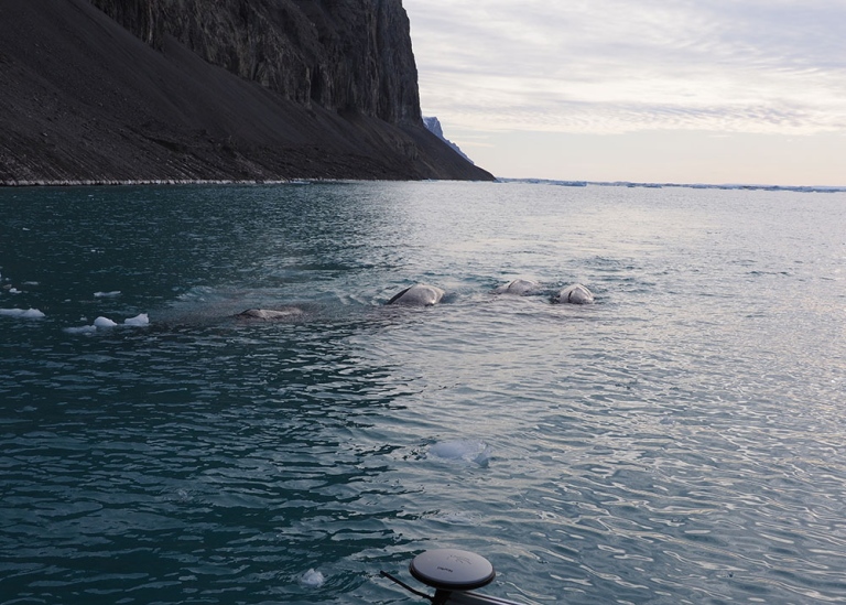
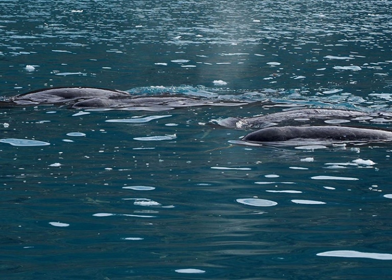
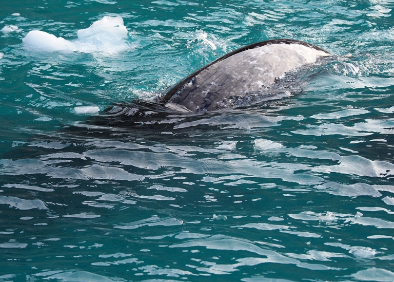
September 2 | Narwhals in Petermann Fjord
Skidbladner is the name of the 6.4 m long aluminum survey boat we brought with us to map at the margins of outlet glaciers and in near shore shallow waters where Oden cannot reach. The name is from the Nordic mythology following the theme of Swedish icebreakers, with Oden being named after the chieftain of all the gods. Skidblader was the gods’ small ship that could be folded up and placed in the pocket when going to war. When it is unfolded, all the gods fits inside and it will always have the wind from behind. A splendid ship to bring along! I brought Skidbladner on Oden for the first time during the SWERUS-C3 2014 Expedition. I got to use it once during SWERUS-C3 in Herald Canyon outside of Wrangel Island. When I was fixing with the starboard GPS antenna sticking out from the bow, a walrus came up from the deep a few meters from my face and snorted right at me. First, my hearth nearly stopped but then we looked at each other for quite a while (or probably every second felt like a minute) before he decided to swim away. Judging from the tusks, it was definitely a “he”. An experience I never forget. Skidbladner was also with us during the first Petermann 2015 Expedition with Oden. I then used the small boat four times with great success. Detailed information of the seafloor in front of one of the calving outlet glaciers in the Petermann Fjord were captured along with other near shore data. As the glacier margin we mapped had no name, we called it “Skidbladner Glacier” in the paper we published in Nature Communication after the cruise.
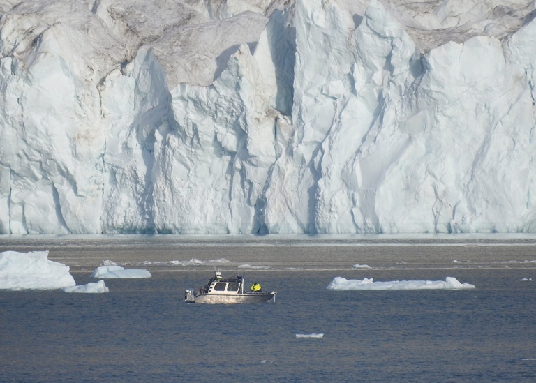
It was now time to launch Skidbladner again in Petermann Fjord. This time our target was the Belgrade Glacier and its calving front close to the eastern side of Petermann’s ice tongue margin. The day was perfect, low wind and only a few scattered clouds. The launch from Oden went smooth. Our objectives were to map the seafloor at the calving front to see if there were traces from enhanced positions of the glacier in the past. We also aimed to collect echo sounding data from the water column to see if we could identify signs of meltwater from the glacier in the ocean with the acoustics. For the latter purpose, we had placed two split beam echo sounders on the towing device I had made for the sub-bottom profiler used in lakes earlier during the expedition. Using acoustics to detect sediment suspension and freshwater is part of Liz Weidner’s PhD thesis project. Liz, Lars Lehnert, technician from Swedish Polar Research Secretariat and I went with Skidbladner to map the area in front of Belgrade Glacier. The data we collected were amazing. We could clearly see fresh water plumes, appearing like it was pressed out of the seafloor. It may sound weird, but it could be water that is escaping from the seafloor due to so called artesian pressure. That is when the water infiltrates the sediment or bedrock strata from a higher level flowing below the ground-surface downwards. This will build up pressure if there is a seal above the flowing water preventing it from escaping.
When we were mapping I thought I saw a blow some hundred meters ahead of us, and I immediately shouted out that I saw a whale. But I was not sure, so the whale was soon downgraded to a seal. But shortly thereafter, we saw five backs coming out of the water ahead of us, definitely whales! They were swimming towards us in a coordinated fashion with a near collision course. We were close to the shore and just at the southern edge of the glacier. It was narwhals. I had the camera close by so I quickly grabbed it and first filmed, then took some photos, and finally filmed again. One came just a meter way from our boat, which did not seem to bother them at al. It appeared like they were very focused on their mission, whatever it was, but most likely looking for food. This was some perfect day, good data and narwhals on top of it!
Senast uppdaterad: 20 maj 2022
Sidansvarig: Department of Geological Sciences